Maps of the Watchung area from Revolutionary War On

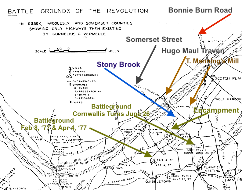
Battlegrounds of the Revolution show the 2 passes thru the Blue Hills (now known as the Watchung Mountains
Revolutionary Watchung

1918 (and 1913) map show what would to be Watchung in North Plainfield labeled Watchung from Rutgers Historical Maps of NJ

1873 map Atlas of Somerset County by Beers, Beer, Comstock and Cline
Stirlng Road: H. N. Howard
Between Stirling and Hillcrest: W. F. Spencer Distillery
Hillcrest Road: J. B. Zeller, T. M., J. B. Holm
Somerset Street: M. H. French, G. D. Stewart, G. Demler Hotel, Vail & French, G. Smalley, H. Coddington, J Miles
Watchung Avenue:
Valley Road: J Wilson, W. Vail, J. B.Hollmes, E. Allen , A. Allen, A.B. Meyer, M. Dinkey, Blackwell, W . Allen
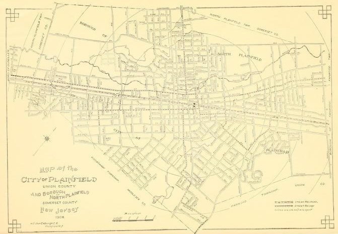
1908 map of Plainfield and North Plainfield

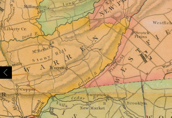
1828 First Official Map of NJ by Thomas Gordon showing Watchung as part of Warren, not labeled at all. Libery Corner, Millington, Mt Bethel, Warren, Scotch Plains, Samptown and Copper are labeled.
Map Henry Guinard showing ice house and public school


1910 Map by Sanborn Fire Insurance from Plainfield Union and Somerset Counties Library of Congress showing Plainfield Ice & supply Texier and police station
1872 Topographical map of Hunterdon and Somerset County by Beers, Beer, Comstock a& Cline
David Rumsey Historical Map Collection

1890 map show what would to be Watchung in North Plainfield but labeled Washington Ville

Central NJ 1838 map shows Millington, Long Hill, Sterling,Mt Bethel, Warren, and the railroad. Below the words “Scotch Plains” is Washington V. as Watchung was called.